

A Whiteparish local history page from younsmere-frustfield.org.uk
This page takes a lighthearted tour of a number of prominent ponds around Whiteparish. The names shown are my own descriptions.
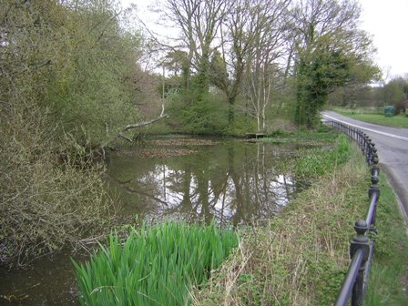
The first pond illustrated is the one alongside the A27 and opposite Courtens Garden Centre in Cowesfield. This forms one of the headwaters of the river Parkwater. In past years full of goldfish, then more recently a home for tadpoles in the due season, in 2015 it featured an unbelievable number of tadpoles of all kinds and large and small. In 2016 and subsequent years there have been very few. The possible reason was becoming clear by 2020: the pond is silting up and is now very shallow, with algal blooms floating on the surface in April after an unbelievably wet winter, repeated in 2021. However, plenty of tadpoles in 2022 after a cooler wetter weather in the early part of the year.
Three views of the pond alongside the A27 in Cowesfield
Then there is the pond below that stands on the edge of the Memorial Ground, left over from clay digging for the old brickworks (add link). It is easy to overlook the fact that it is there at all, next to the new Memorial Centre. In the 1980s villagers, including Cubs and Scouts from the Whiteparish Group, spend a day maintaining and improving it under the watchful eye of Pat Woodruffe and of course it featured as a delay in the long and tortuous process of preparing to build the new hall when it was reported that it contained great crested newts (in common with almost every pond in the village, of course). This particular view of it features the then recently built Steeple Barn, the house high up behind the surgery.
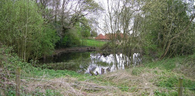
Memorial Ground pond
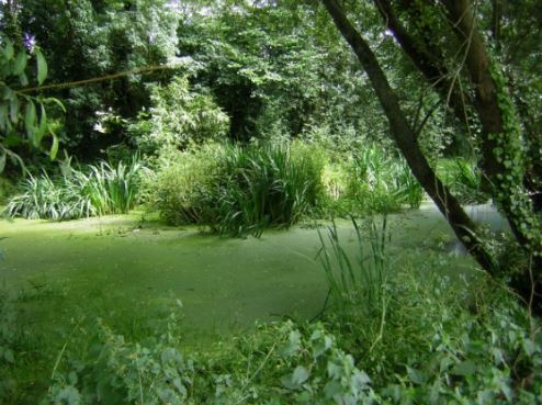
Ashmore (Alderstone) pond (below) is next to Alderstone House and opposite the farm drive to Alderstone Farm. Although largely under trees it forms a significant landmark both winter and summer, with the July 2016 view below when covered with duckweed reflecting the cold and wet spring and summer that year.
 .
. 
Ashmore pond in July 2016 and March 2019 [2020 pictures may be better]

Ashmore Pond on the 1876 OS 25 inch to a mile map
There is also a pond opposite and north of Poundside Cottage to the east of Common Road and also north of the Golden's Farm entrance. This was pointed out to me by by Brian Snelgar (30.4.2018) and is shown on maps up to 1962, not being present on the 1966 OS map. This pond is very much still there, but has been overgrown by tangled woodland [add my modern photograph of the spot].
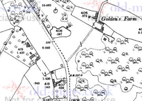
The pond on Common Road near Golden's Farm and Poundside Cottage shown on 1901 1:2500 OS map, parcel 406 [old-maps.co.uk]
Another old pond lies on the right of the A27 just before the Hampshire border, opposite the entrance lodges to Broxmore Park. This is shown as parcel 1333 on the 1842 Tithe Map, described there as water and a plantation. The 1896 OS map below shows coniferous trees in the fenced area around the pond. the 1967 OS map shows the same fenced area round the pond. Today (2019) it lies within the area previously labelled as common and now forms part of the land associated with Broxmore Drove Cottage, the whole of which was unfenced and assumed to be common land until quite recently (~2005?).
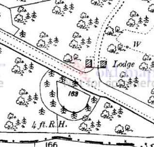
The pond by the A27 opposite the Broxmore Park lodges in 1896 (parcel 168) old-maps.co.uk
Giles Eyre's pond was such a local landmark that it was a stage point on the local turnpikes. It stood close to the present junction of the A27 and A36 at Brickworth Corner, in front of where the garage/car wash/cafe now stands [2020]. There were significant changes to the road junction between 1926 and 1962 [get more accurate date], so an additional map is shown below that helps relate the pond to the old and current road layouts. The first map here is the 1842 Tithe Map.

Giles Eyre's pond on the 1842 Tithe Map (north to left)
The area is now grassed and to relate the pond to the ground today the map below shows a tracing of the 1901 map in red overlaid on the 1962 Ordnance Survey map. This indicates how the A36 used to leave the A27 at a T junction east of the pond and run eastwards round the building line to the north of the grass that is there today. There is further detailed discussion of the evolution of the road junction over the years on the Roads page and on the Brickworth page.
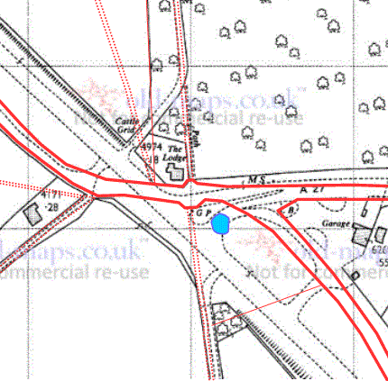
Map showing the relationship between modern roads and the older A27 and A36
Frogmore House in Parkwater Road, Cowesfield, drained and improved a marshy area alongside the A27 at the point where the old road past Testwood Cottages deviates from the A27, creating a new pond in [about 2010?]. The alpacas, marsh marigolds and parkland setting now present a pleasant view from the road.


Pond alongside A27 (Frogmore House grounds) and with marsh marigolds April 2022

Frogmore House pond opposite Cowesfield Lodge on the A27
Ashdod Pond lies on Moor Lane near Ashdod House immediately east of the site of the mediaeval settlement of Moor. [Add a map and photograph]