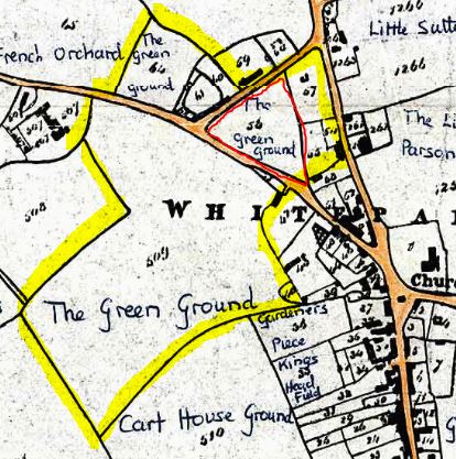
Possible extent of Alderstone village green based on the 1842 Tithe Map; The Triangle outlined in red
A Whiteparish local history page from younsmere-frustfield.org.uk
A small development of ten houses (plus Crompton House on Ashmore Lane) built by Shearings in 1975 [check date] on the remaining area of the old Alderstone village green. The land had been in use as a milk haulage depot by Dears Dairy Haulage. When a corner of the back lawn at number 8 started sinking in around 1990, the owners dug down to find the cause and discovered the edge of the tyre of a very large lorry wheel - the sinkage was accepted as inevitable and the wheel left in peace!
Possible extent of Alderstone village green based on the 1842 Tithe Map; The Triangle outlined in red
This land was the last remaining (triangular) part of the Alderstone village green. In more recent years it had been used as a poultry yard then taken over as a milk haulage depot by the Dear family. Dears Dairy Haulage moved to the bottom of Common Road, where the lorries were a common site until BKG was set up in the late 1990s [check date]. The houses still have in their deeds a restrictive covenant specifically forbidding the running of a milk haulage business.
The Green originally occupied a lot more that the outline of The Triangle development, and may have continued southwards to Bunkers Hill, as shown above. The southern edge of the triangular area along Bunkers Hill had houses along it by 1842. There are two old properties remaining - The Gables, a cottage that stands a little back from the road south of Crompton House across the road from The Lynches that was already there by 1842; and The White Hart Public House, now converted into houses. A terraced row of cottages stood on this side of Bunkers Hill opposite Little Suttons (see Bunkers Hill). See The Green for maps and pictures of houses along the road named "The Green".
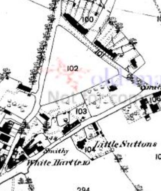
The Triangle in 1876 Old-maps.co.uk
The 1876 and 1901 maps above and below show that the area remained undeveloped and indeed was still so on the 1970 1:10560 map.
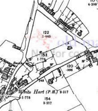
The Triangle in 1901 Old-maps.co.uk
The map of 1978 shows the new development very much as it remains today.
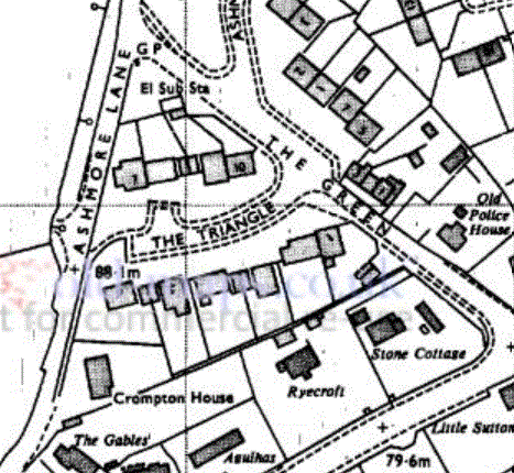
The Triangle in 1978 - Crompton House is part of The Triangle development Old-maps.co.uk
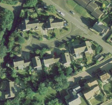
The Triangle, copyright 2009 Google
[There are more documents and records to be added.]