
A Whiteparish local history page from younsmere-frustfield.org.uk
BKG (link no longer active 21.9.2021) is a haulage business on the left close to Common Road just past the south end of Whiteparish village. By 2021 it had become 3TC Logistics.
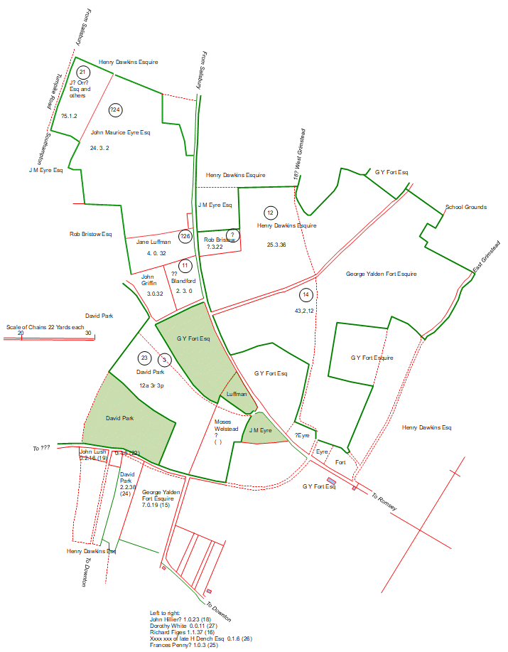
On the 1842 Tithe map parcel 1229, Little Meadow, was owned and occupied by Thomas Hobbs, whereas most of the surrounding land was owned by Countess Nelson and George Yalden Fort and farmed as Common Farm and Golding's and Rowell's Farm, both sections of Blaxwell Manor. This one field is still in separate ownership and is now the site of the BKG haulage business. There is a small house and a large lorry park with its associated buildings. Was this smallholding perhaps a separate assart from the common, or a tithe assignment?
.jpg)
The BKG site on the 1842 Tithe Map (north is to the left) - for full map see 1842 Tithe Map landowners and occupiers
[This section could usefully form a separate page or be moved to the People in 1842 page, from which his name currently links to this BKG page.]
Thomas Hobbs owned ten pieces of land, including two houses and three cottages, but rented them all out to others - see Whiteparish.co.uk for a list. He is not listed at all as an occupier of land in Whiteparish so may have lived elsewhere, unless perhaps he was one of the "others" listed under the 3 cottages.
Thomas Hobbs' two fields in Tipple Field (776 and 795) can be traced back to the 1804 Whelpley Enclosure Award, where they were awarded to Jane Luffman and John Griffin respectively. See Tithe Map for general detail and here for a detailed map, noting that the 1804 map is upside down, with north downwards. He also owned Barn Piece (802 on the 1842 map) and three cottages and gardens alongside, these also having been allocated to Jane Luffman in 1804. These lie across the road a few yards closer to Salisbury, within what is now the last block of houses on the left as you leave the village.
Another section of his land was nearby and consisted of two houses, two gardens and a paddock opposite the Newton Lane junction with The Street and Welsteads.
The final piece of his land was Noyes Hill on Pill Hill (parcel 545), this being north of the School Ground on the edge of Sansoms Down.