This page is still under construction - more material to be added
Change map dates from publication dates to revision dates
An introduction to the four Whiteparish Brickworks can be found here.
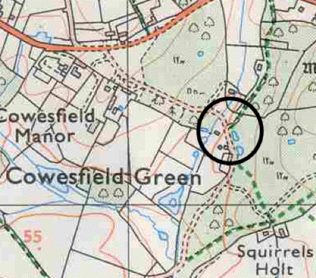
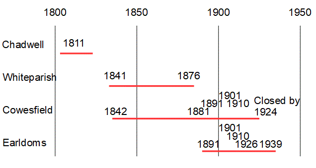
The Cowesfield Brickkiln was already in place in 1842, was active in 1900 and probably closed by 1924. It was situated on Parkwater Road in the area now occupied by Yew Tree Farm, with ponds resulting from clay digging still visible by the east side of the road and another pit beyond these 150 metres into Cowesfield Wood.
Earldoms brickworks operated at the same time as Cowesfield and we know that Earldoms closed at the onset of world war 2. Scotch kilns, being open to the sky, would have assisted enemy aircraft navigation, and were banned from 1939. It is known that Earldoms brickworks used a Scotch kiln and closed in 1939 as a result, but the 1824 25" OS map shows Cowesfield as disused, this map having been published in 1926.
Map and census records of individual brickworks (diagram still being built)
Cowesfield brick kiln was already well established by 1842, with the general layout of buildings at that date very much the same as seen on later maps. The land on which it stood was part of Cowesfield Esturmy manor, owned at the time by Lady Selina Mary Fremantle. The brickworks were occupied and presumably worked by William Hurst, who occupied two houses on the site. He used much of the area around the brickyard buildings as an orchard. Two ponds across the road had presumably been dug for clay, these being in Cowesfield Wood, which Lady Fremantle owned and occupied herself. These are still there today.
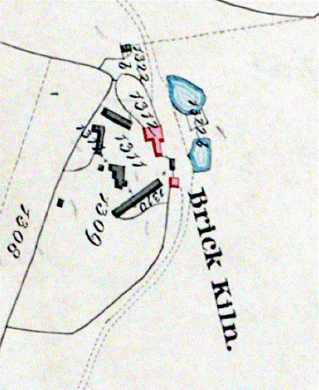
Cowesfield brick kiln on the 1842 Tithe Map
- 1308 Little Mead, pasture 1-3-10, owned by Lady Selina Mary Fremantle, occupied by John Fox
- 1309 Orchard, pasture 1-1-38, owned by Lady Selina Mary Fremantle, occupied by William Hurst
- 1310 Buildings and yards 0-0-38, owned by Lady Selina Mary Fremantle, occupied by William Hurst
- 1311 House, garden and yard 0-1-34, owned by Lady Selina Mary Fremantle, occupied by William Hurst
- 1312 House and garden 0-0-24, owned by Lady Selina Mary Fremantle, occupied by William Hurst
- 1322b Cowesfield Wood, wood 43-0-29, owned by Lady Selina Mary Fremantle, occupied by Lady Selina Mary Fremantle,
Looking at the three 25" (1:2500) maps in more detail, the 1876 map shows an extensive set of buildings and a clay pit to the east of the brickworks. This clay pit shows on the next two maps below as well, and can be seen on the modern map at the top of this page as a pond immediately to the east of the circle marking the site.
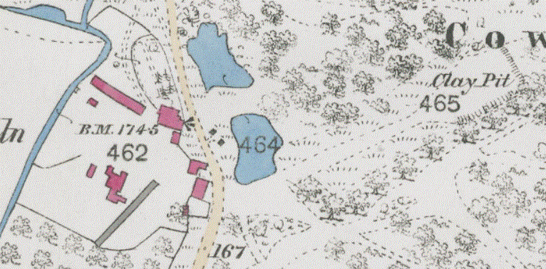
Cowesfield Brickkiln on the 1876 OS 1:2500 map
By the time of the 1900 map a new kiln had been built alongside the clay pit, already shown as disused. There is more structure shown in the tracks leading to this pit from the brickworks and the map shows some minor changes to the buildings on site.
 OS 1-2500.gif)
Cowesfield Brickkiln on the 1909 (revised 1900) OS 1:2500 map
The third map in this series, revised in 1924, shows further changes to buildings and the words "old kilns". The clay pit showns no sign of further digging, but it is possible this was not resurveyed. The label suggests that the brickworks was no longer in use, but it has to be considered that active kilns might not have been labelled, had there been any. On the whole, it looks as if brick making had ceased on the site by then. Other sources are being investigated to provide more clarity and detail.
 OS 1-2500.gif)
Cowesfield Brickkiln on the 1926 (revised 1924) OS 1:2500 map
Yew Tree Farm and The Barns now stand on this site. There appears to be some continuity between the house shown on earlier maps above and the part of the Yew Tree Farm house closest to the road, which is possibly the case also for the buildings of The Barns [further research taking place into these buildings]. As observed above, the two ponds across the road were already there by 1842. The pond/lake to the west of the Yew Tree Farm buildings was dug more recently, probably since 1983 [Research continuing].
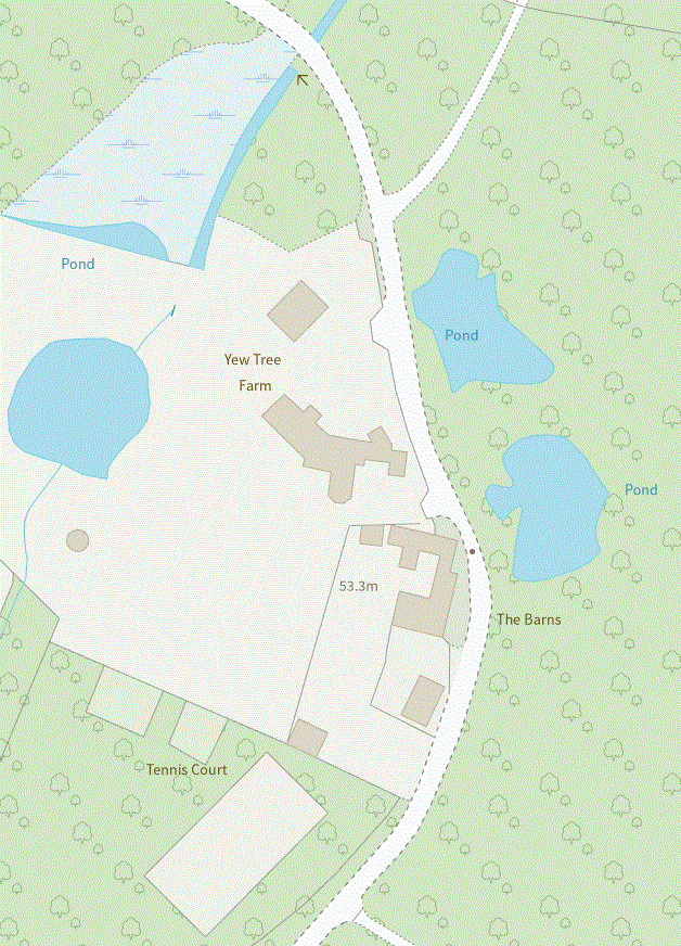
The site is now Yew Tree Farm and The Barns
For further information and ongoing research into the Cowesfield Brickkiln see here.