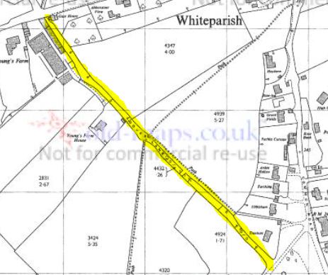
Doves Lane on the 1978 1:2500 OS map Old-maps.co.uk
A Whiteparish local history page from younsmere-frustfield.org.uk
Doves Lane on the 1978 1:2500 OS map Old-maps.co.uk
Doves Lane originally ran from The Street alongside the Gate House opposite Pill Hill to the top of Clay Street immediately behind Treetops. Only the section at the north end is still a lane, with the south end overgrown and terminating in a sunken pond where rain water drains in wet weather. The footpath that continues the right of way now branches eastwards 80 metres from Clay Street to emerge onto the common land opposite the school between Ebbisham and Treetops, thus avoiding the wet and boggy section. The level of Clay Street has been significantly raised since Doves Lane was last in regular use, effectively forming a dam across the end of Doves Lane.
At the north end, Doves Lane ran alongside Younge's Farm. All that remained of this by 1983 were old building footings and the site was redeveloped as a set of ?four large houses [name them and give a date]. Younge's Farm is still represented by Younge's Farm House, the home of Eric and Margaret Chase (2019).
The 1842 Tithe Map below shows the two fields called Doves and Doves Meadow that presumably gave it its name, both of which were owned and occupied by Robert Cooper of Whelpley Manor. Parsonage Meadow on the other side of the lane is part of Alderstone Manor, owned at the time by Robert Bristow. Doves Lane forms part of the boundary between the two manors at this point, with the edge of Whelpley Manor continued at one time by Love Lane and later by Common Road.
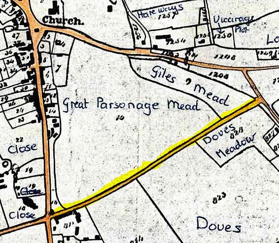
Doves Lane on the 1842 Tithe Map (north to left side of map)
The junction of Doves Lane with Clay Street is set back from Common Road, aligning with the edge of the old common grazing strip that ran into the village along Common Road and Clay Street. The map below shows how Doves Lane and Love Lane both align with the western edge of this, rather than directly with Common Road. As can be seen, parts of this common land had already been taken along this stretch by 1842, the remaining sections being labelled as 1208.
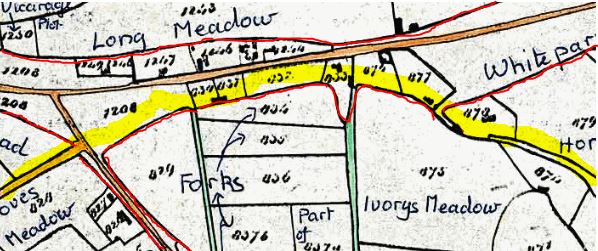
The alignment of Doves Lane (left) and Love Lane (right) in 1842 (north to left side of map)
The next map, from 1876, shows that the Clay Street end of Doves Lane had been fenced off between 1842 and 1876, with the footpaths running very much along their modern lines even that early.

The Clay Street end of Doves Lane in 1842 Old-maps.co.uk